• Home
  • News
  • About Us
    • Genealogy
  • Donate
    • Donations
  • Contact
  • Plan Your Visit
    • Google Map
  • Links
  • Events
    • Monument Unveiling
    • 2024 Reunion
  • Research
    • Past
    • New
  • Welcome to Monument LeBlanc

  • bienvenue à LeBlanc Monument

  • 1
  • 2

News

August 15th, 2017, Happy Acadian Day!

  • Print

DSCN2900

Sunset August 12th, 2017 on the Annapolis River, near the Leblanc Monument.

  • Print

DSCN2862 eagle.modified


DSCN2855 modified

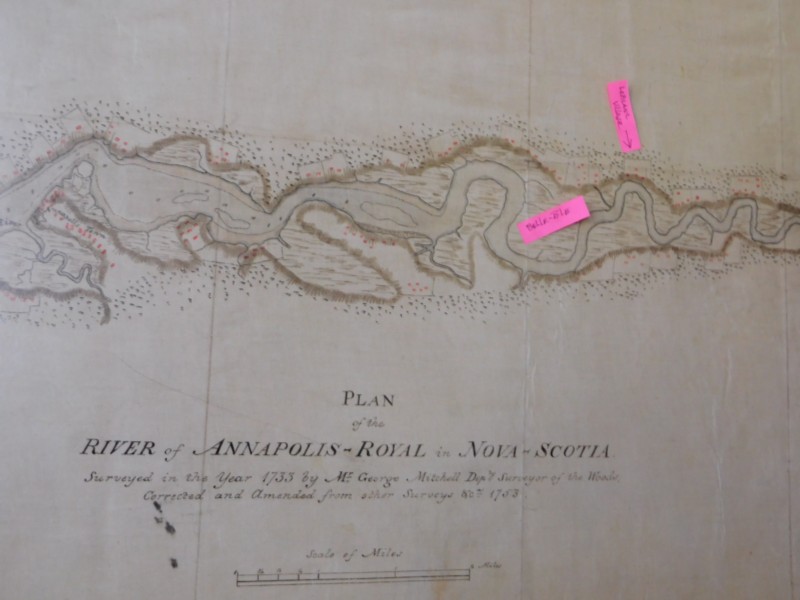
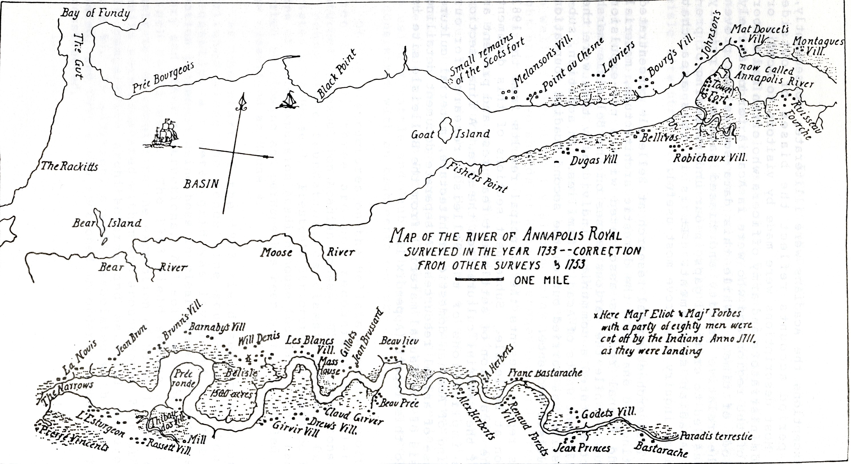
Close up snapshot of the 1753 updated map “Plan of the River of the Annapolis Royal in Nova Scotia” drawn by George Mitchell Department Surveyor of the Woods.

  • Print

DSCN2848 mitchell.modified

Old

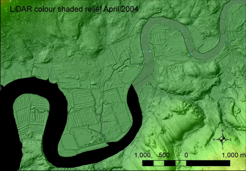
Copy of the Lidar study map that was done in 2004 by the Lawrencetown Community College with objective to identify (with the assistance of the 1733-53 Mitchel Maps) high land elevation areas where pre-deportation Acadian houses could have been located.

  • Print

Belle Isle May2003 LiDAR modified


Two additional “aboiteaux” located near the Belle-Isle Marsh!

  • Print

P1010265


P1010262 Copy

More Articles ...

  1. Fédération acadienne de la Nouvelle-Écosse - News related to the Belle-Isle Marsh
  2. 1753 Annapolis Royal Map
  3. Délabat Map 1710
  4. Recent pictures taken at dusk on the Annapolis River near the LeBlanc Monument.

Page 27 of 30

  • Start
  • Prev
  • 21
  • 22
  • 23
  • 24
  • 25
  • 26
  • 27
  • 28
  • 29
  • 30
  • Next
  • End
Powered by Fundy Hosting